Lakahia Island, located in the Teluk Etna District, is somewhat distant from the capital of Kaimana. The only way to get there is by sea. People can choose to use an outboard long boat, which takes 5-6 hours, or the Sabuk Nusantara vessel, which takes 10-12 hours.
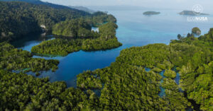
Lakahia covers an area of 27,895.63 hectares. To circle the island, we can walk for an hour or take a motorboat for 20-30 minutes. Despite being a small island, the community there is very aware of the importance of territorial recognition. Moreover, there are plans to split the Etna area into a new district in the coming years. “If Etna is divided into a new district, there will be many people coming in and very busy activities that will affect our territory,” said Lakahia Traditional Elder, Melikianus Tenawe.
Read Also: Victory! Indigenous Communities Secure Their Ancestral Lands
If their land is not recognized by the government, the community fears there will be conflicts in the future. Their land is their source of livelihood, where they meet their daily needs. To anticipate this, the community has agreed to conduct participatory mapping of their territories with the support of EcoNusa as part of the protection of their land and indigenous community.
Protecting Customary Territory through Participatory Mapping
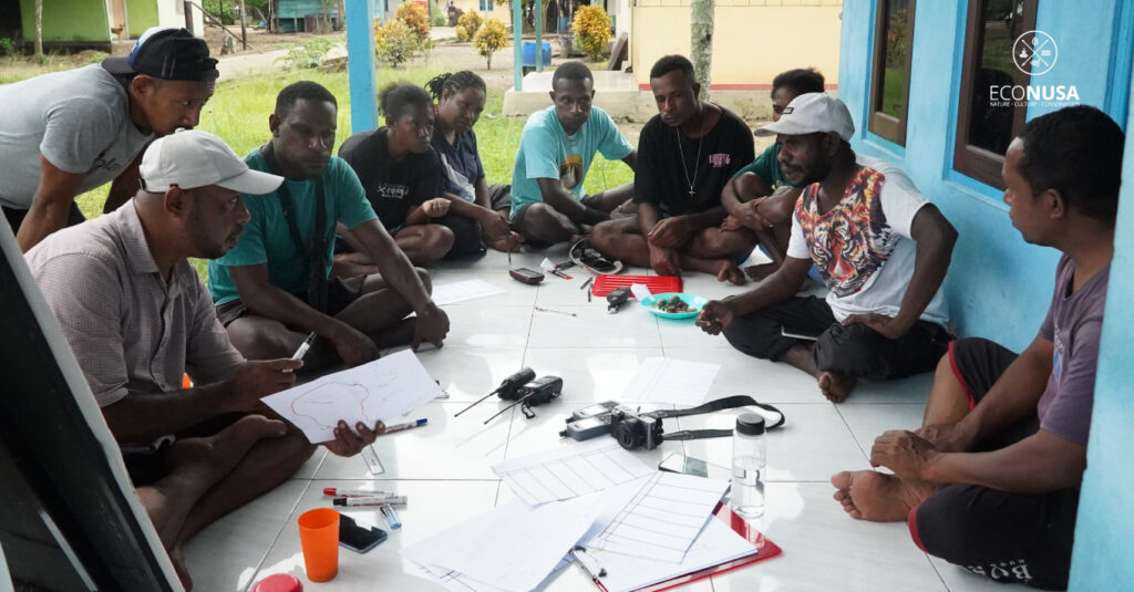
Before the mapping of traditional territories began, the EcoNusa team conducted a process of free, prior, and informed consent (FPIC) on June 9, 2024. FPIC is a specific right granted to indigenous communities, recognized in the UN Declaration on the Rights of Indigenous Peoples (UNDRIP). FPIC allows indigenous communities to give, withhold, or withdraw consent at any time regarding activities that impact their territories. It enables indigenous communities to engage in negotiations to determine the design, implementation, monitoring, and evaluation of activities.
During the FPIC meeting, representatives from five sub-tribes residing in Lakahia—Owapi, Motarimarra, Umuwae, Eparipi, and Otaripiti—expressed their commitment to conducting participatory mapping of their traditional territories, both marine and terrestrial areas. These five sub-tribes represent 13 clans: Nay, Onoma, Aribu, Werbay, Gofa, Amerbay, Tenawe, Ayambi, Waterpauw, Esnu, Mairuma, Muaripi, and Atiamona.
Read Also: A Travel Note: The Ireres Tribe Unites to Protect Indigenous Territories
Salmon Nay, a village representative, said that the agreement for the mapping of traditional territories is one way to minimize problems with neighboring villages. “We all agree with this agreement to prevent territorial boundary conflicts between neighboring villages. And I believe that the mapping of customary territories facilitated by the EcoNusa team is entirely to protect our lands in Lakahia,” he said.
Following this agreement, a community mapping team was formed. The team consists of social and spatial teams. They conducted the mapping of traditional territories from June 10-24, 2024. In this mapping process, neighboring village communities were also involved to agree on territorial boundaries. Subsequently, a traditional council meeting will be held with neighboring clans to approve the jointly created map.
Natural Wealth of Lakahia
Despite its small size, Lakahia Island is rich in natural resources, both on land and at sea. The community uses the land on this small island to meet their daily needs. They plant various types of crops for consumption, such as coconuts, durians, mangoes, areca nuts, cassava, sweet potatoes, langsat, kedondong, lemons, sago, guavas, jackfruit, sugarcane, and sea almonds. In addition to fishing, the community also raises chickens to meet their protein needs.
For coastal and marine areas, Lakahia has mangrove ecosystems, seagrass beds, and coral reefs. The mangrove forest area hosts various species, such as mangrove (Rhizophora Sp.), red mangrove (Bruguiera Sp.), white mangrove (Avicennia Sp.), white piddada (Sonneratia alba), Ceriops tagal, nipa palm (Nypa fruticans), and beach morning glory (Ipomoea pes caprae). Besides preventing erosion and coastal abrasion, the mangrove forest also serves as an important breeding ground for fish, shrimp, and various other marine animals.
Read Also: Natural Wealth and Development Challenges in Papua and Maluku
Lakahia also boasts abundant marine resources. The island has seagrass ecosystems with two types of plants: Syringodium isoetifolium and Thalassia hemprichii. These seagrass areas and their surrounding ecosystems serve as playgrounds for fish. In these waters, the community often encounters lema (mackerel), mackerel tuna, red snapper, crabs, sea cucumbers, and dugongs that appear daily along the coast. Various types of shellfish such as lola, batulaga, and giant clams are also present. Additionally, Lakahia is a migration route for marine mammals (cetaceans) and leatherback turtles.
All these resources are wisely managed and utilized by the community. They are only allowed to take what they need. Mapping is one of the community’s efforts to preserve natural resources. After the participatory mapping of traditional territories in the village, the next step is to propose the recognition of these traditional territories by the local government through a Decree from the Regent of Kaimana. This process will proceed with the assistance of EcoNusa to develop sustainable economic initiatives, such as the utilization of non-timber forest products and fisheries.
Editor: Nur Alfiyah