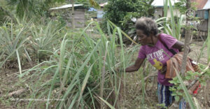
Ireres District in Tambrauw Regency, Southwest Papua has abundant natural resources. This region has dense forest cover and hills containing minerals and metals. The Ireres District is inhabited by the Ireres ethnic community consisting of 12 clans namely Syufi, Fatemasa, Aibesa I, Aibesa II, Apoki, Aneti, Airai, Isuskey, Sasyor, Umagi, Fanemato, and Aifamas.
The Ireres people live side by side with nature, from foraging to recreation, which is also reflected in the traditional laws and norms that incorporate elements of nature. However, these resources are threatened by destructive investments.
The local communities have realized that their customary territory is a “sexy and beautiful” area so that it becomes a bone of contention for many groups to change their territory into a business area. Some communities also admit that their territories have been subject to intervention by mining companies and they firmly refuse because such intervention is a threat to their ancestral territories. Therefore, recognition of indigenous peoples’ territorial rights is important.
Read Also: Fulfilling Nutrition from Own Farm
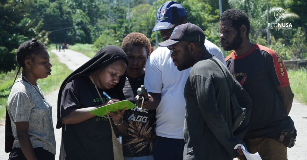
Participatory mapping is one of the steps to get recognition of the rights of indigenous peoples by the government. More than 30 participants from 12 major clans of Ireres took part in participatory mapping training initiated by the EcoNusa Foundation, after previously conducting training and provisioning on free, prior and informed consent (FPIC) or approval from the community and indigenous communities which was held in Mibi Village, Makbon District, Sorong (27/2-01/3). Various technical materials on territorial mapping and the stages of obtaining legality in protecting customary territories were enthusiastically followed during the five days of training on 24-28 July 2023.
On the first day, all participants began studying the process of collecting and filling in social, economic and cultural data to meet the requirements for proposing customary territories to the customary law community committee. Regarding culture, there are 7 pillars of data that must be fulfilled, namely history, customary management areas, customary law, governance systems, customary assets, customary belief systems, and biodiversity in customary areas.
Technical implementation of participatory mapping began to be delivered on the second day. An introduction to the tools used for mapping customary territories, such as the use of the global positioning system (GPS) tool and filling out tally sheets (count sheets) was conveyed which were then practiced directly by participants representing each clan, especially young people, by walking around the area training.
Read Also: Good News, Gelek Ulim Abgies Pela Customary Territory Receives Government Recognition
On the third day, the tribe elders described and explained their traditional territories from a historical and experience point of view. The participants were then divided into groups per clan whose task was to describe their customary territory, starting from the boundaries to the ancestral history.
A more detailed participatory mapping guide was presented on the fourth day. The stages of the process of recognizing customary territories from a positive legal perspective that need to be well prepared are explained to the participants so that the necessary documents are prepared by each clan. On the last day of the training, participants are facilitated in preparing follow-up plans to be carried out by each clan.
All participants were very curious and excited throughout the training. Representatives of the tribe elders were actively participating in all activities throughout the sessions. Their commitment was also shown from the presence of young and old female figures who took part in small group exercises. Voices from female leaders were conveyed and became important inputs according to the material provided.
Read Also: Tribal Assembly on Recognition of Ulim Abgies Pela and Ulimpa Obokmala Clans Rights Running Well
During the follow-up planning activities, the clans agreed to do many things together. These include determining a secretariat or mapping lodge, completing data and historical documents on the 7 pillars, reaching agreements with outside clans or neighboring clans as evidenced by written minutes, image mapping with the inner and outer clans, and customary meetings to the preparation of customary territory management plan documents.
The cohesiveness of the 12 major clans of the Ireres tribe is proof that the Ireres tribe is serious about mapping their territories to protect not only the beauty of their customary territories but also the rights of indigenous peoples which cannot be separated from the integrity of the ecosystem within them. It is hoped that the efforts of the indigenous people of the Ireres tribe will soon receive good reception and recognition from the government.
Editor: Nur Alfiyah, Swiny Adestika