Mapping is not merely about measuring distance or determining coordinates.
Every step on that land is a journey through stories and memories passed down from one generation to the next.
First Footsteps: Wufmana Village
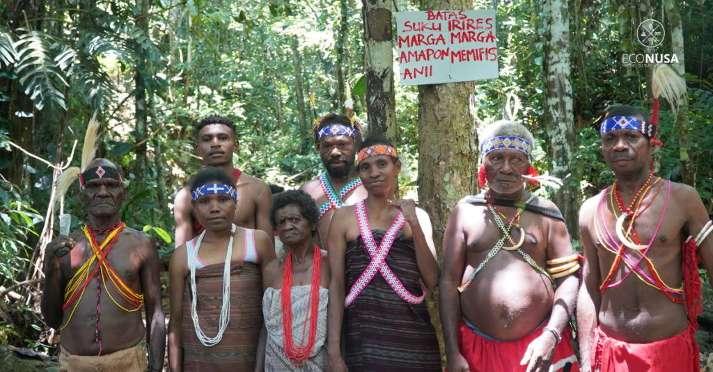
I took a deep breath as I first set foot in Wufmana Village, Ireres District, Tambrauw, Southwest Papua, in September 2025. That afternoon, in the house of the Clan Chief, the elders were already seated in a circle. I greeted each of them one by one. The aroma of betel leaf, areca nut, and lime mixed with the warmth of the afternoon coffee, guiding conversations that flowed through long-held memories.
“Ah, that’s next to Kamundan clan, Sedik Ame’s place! Over to the east is the Asiti clan! I am the one who owns that area, so I know!” an elder exclaimed, his voice firm and sharp, delivered in the distinct Wufmana dialect. The tone startled me at first, though it was simply their way of asserting stories with conviction.
Related Article: From Tradition to Title: Mapping the Irires Tribe’s Customary Territory
After a long discussion, we agreed: the next morning we would go into the field to confirm each clan boundary directly.
Walking the Forest, Following the Stories
The following morning, sunlight pierced through the leaves. The mapping team set off. Leading the way was Bapak Martinus, the customary elder, clearing the path with his machete. Behind him were the young men opening the trail, followed by the EcoNusa team—Charles, David, and Berto—who occasionally laughed to keep the journey lively and captured photos along the way.
The mothers carried noken filled with food supplies, children ran around energetically, and two village dogs followed faithfully. They all seemed accustomed to walking the forest trails, some of which were quite steep. I, on the other hand, was out of breath, trying my best to match their pace.
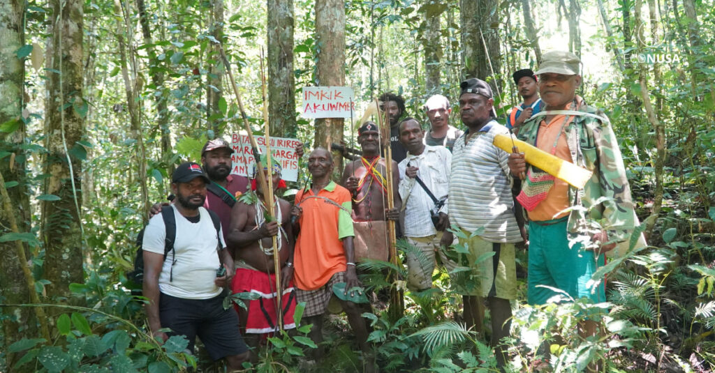
We walked through forest areas that the community has long protected—forests that sustain their lives. Each time we stopped, the elders recounted old stories: places where they once hunted, processed sago, or performed sacred rituals. The young men activated the GPS, waiting for the satellite signal to stabilize.
Coordinates slowly appeared on the screen: 0°51’57.82″S, 132°54’54.64″E.
“Bapak, shall we mark this as the clan boundary?” I asked.
Bapak Martinus nodded.
“Yes, from the bend of the old river heading west to the big stone by the former riverbed. That used to be the boundary.”
Berto photographed the large stone. David wrote in his notes: old Asiti river.
That was how every point was documented: coordinates, boundary descriptions, customary stories, and photographs.
From Points to a Map
Later that afternoon at the pastoral house, I transferred the data to a laptop. On the screen, the points we had collected began to connect. Lines slowly formed: rivers, hills, forests, swamps—shaping an initial map of the ancestral territory.
After some time, the map was finally complete. Clan boundaries, rivers, forests, hills, and swamps all appeared with point codes, coordinates, and customary notes.
Related Article: Meeting with DPD Committee II, Communities Hope for Recognition of Customary Forests
The Clan Chief stood for a long moment, gazing at it.
“Now, these boundaries are no longer just in our memory,” he said quietly.
“They now live on this map, a map that is not merely lines and numbers, but a reflection of who we are and where we belong.”
The map now holds more than data.
It holds a soul—the soul of the land and the people who safeguard it.
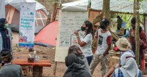
For the Irires community, ancestral land is not simply a legacy; it is a foundation of life. Since 2023, the EcoNusa Foundation has been supporting the community in advocating for territorial recognition. The process includes FPIC, work-plan development, formation of a customary management body, and the initial collection of boundary coordinates.
To this day, the accompaniment continues. The mapping progresses from one clan to another, ensuring that their rights remain protected.