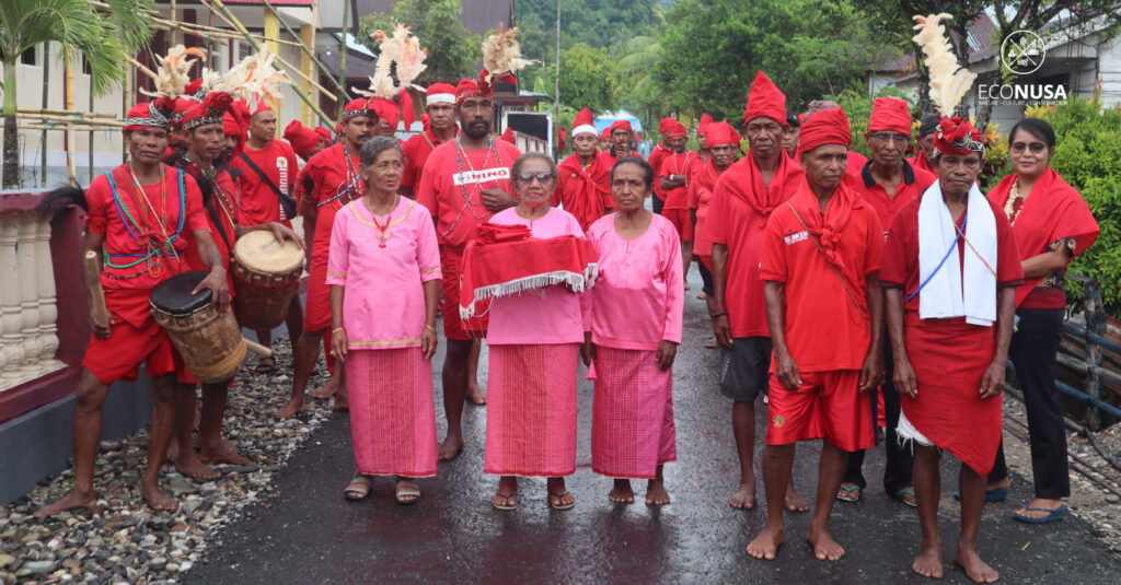
The village hall of Negeri Hatumete was unusually crowded that afternoon. Men dressed in red traditional attire sat cross-legged on the floor, gathering to attend a customary council meeting aimed at finalizing the traditional territorial boundaries of Negeri Hatumete. In addition to the residents of Negeri Hatumete, the meeting was attended by the Chair and Secretary of the Latupati Council of Tehoru Subdistrict, the Head of Tehoru Subdistrict, and traditional leaders including the Kings and Heads of Soa Tehuaayo from Negeri Telutih Baru and Negeri Mosso, as well as representatives from Negeri Hatu and Negeri Piliana, among others.
Held on January 31, 2025, the customary council session aimed to formally establish and recognize the traditional land boundaries to prevent potential conflicts between indigenous communities and external parties, and to support future official recognition by the government or relevant institutions. During the meeting, elders of Negeri Hatumete shared ancestral stories passed down through generations regarding the ownership and stewardship of their traditional territory.
Read Also: The Coming-of-Age Tradition for Ireres Girls
According to the elders, Negeri Hatumete is bordered to the east by Negeri Mosso and Negeri Telutih Baru, with the boundaries marked by Tane Hill, Teheihata, and the Kowe River. To the west, it borders Negeri Piliana and Negeri Hatu, with boundaries delineated by Hatusurupai, the Mika River, and the Yalamata River. Based on these oral histories, a participatory mapping team composed of community members and supported by EcoNusa mapped the traditional territory of Negeri Hatumete at approximately 1,504.48 hectares.
However, representatives from Soa Tehuayo of Negeri Mosso and Soa Ilela Potoa of Negeri Piliana contested these boundaries. According to their ancestral accounts, the borders differed from those presented. To resolve the discrepancy, a joint deliberation was held, mediated by traditional leaders from each community.
The dialogue among the elders delved into the historical migration and settlement patterns of various clans, tracing their journeys from three sacred mountains—Mount Murkele, Mount Binaia, and Mount Hoale—eventually forming their respective villages and customary territories. Through this historical lens, a mutual agreement was reached: the Yalamataarea, previously claimed by Piliana, was recognized as part of Hatumete; while Tane Hill, previously under Hatumete’s territory, was acknowledged as part of Negeri Mosso. As a result, the revised and mutually agreed territory of Negeri Hatumete is now 1,436.48 hectares.
Read Also: Albumin Pills: Non-Timber Forest Product from Boven Digoel
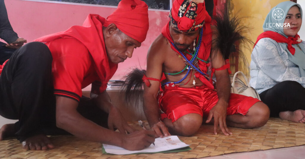
Following the agreement, a written declaration of consensus was signed by all parties involved. The customary council session concluded with the communal sharing of betel nut, a traditional symbol of unity and agreement among participants.
Subsequent to the customary proceedings, representatives of the indigenous legal community and the EcoNusa team met with the legal division of the Central Maluku Regency Government to consult on the procedures for submitting documents related to indigenous rights in Negeri Hatumete. During the meeting, the King of Negeri Hatumete presented detailed explanations regarding the objectives of the documentation process, particularly concerning official recognition of traditional territory and associated rights.
The community hopes that with formal recognition by regional and national authorities, they will gain the legal autonomy to sustainably manage the natural resources within their ancestral land.