Ombanariki Village is a remote settlement located in the Teluk Etna District of Kaimana Regency, West Papua. It borders Mimika Regency in Central Papua Province and lies approximately 150 kilometers from Kaimana City and 80 kilometers from the district capital, Kiruru. Reaching Ombanariki from Kaimana requires a boat journey of five to six hours, depending on the number of engines used and prevailing weather conditions.
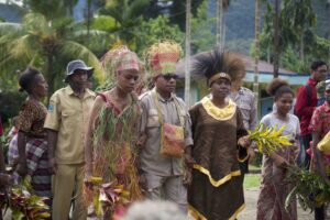
Despite its considerable distance from urban centers, the people of Ombanariki are deeply aware of the importance of preserving their natural resources for future generations. “Our land holds many sago groves and places that provide our livelihood, which I believe must be protected before they are damaged by external interests,” stated Yance Kamandairai, a traditional elder in Ombanariki.
Read Also: Aara Indigenous Community Proposes Recognition of Customary Land
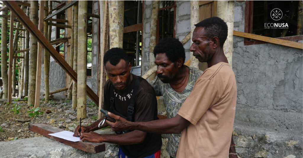
Driven by this awareness, the community requested the support of the EcoNusa Foundation to facilitate participatory mapping of their customary land. They had previously learned of EcoNusa’s assistance in mapping the customary territory of the Aara community in Lakahia. The mapping process in Ombanariki began in early 2025 and was carried out entirely through a participatory approach by the Indigenous community themselves. It commenced with an assessment to develop a mapping plan, during which the community gave their full consent to proceed. This initiative forms part of a broader effort to strengthen the governance of customary land and anticipate future land use pressures.
Subsequent meetings focused on identifying and confirming the boundaries of Ombanariki Village. Community members actively participated in delineating the village’s territory: to the east, it borders clan lands in Potowai, Mimika Regency; to the north, it borders Wosokuno Village; to the west, it meets the land of the Aara Indigenous community; and to the south, it is bounded by the Arafura Sea. The total indicative area of their customary land is approximately 61,000 hectares.
In addition to territorial mapping, data collection was also conducted regarding the village population and existing facilities. The community comprises 16 clans, including Omapoka, Kumuti, Akerpea, Tenama, Wauw, Naimu, Uri, Kamandiray, Moy, Bonira, Maripau, Yemuni, Umari, Suy, Kaway, and Mautupeau. In general, the people of Ombanariki belong to the Napiti/Komoro ethnic group.
Read Also: The Lakahia Community is Committed to Protecting Customary Territories
The village’s public facilities are in a state of disrepair. Electricity is available only from 6:00 PM to 6:00 AM, although mobile network coverage is accessible throughout the day. The school building is severely damaged, and there are currently no teaching staff available. As a result, nearly all primary school-aged children have not attended school for over a year. The health center (Puskesmas) building exists, but no healthcare personnel are stationed there. The community earnestly hopes for urgent government intervention to address these issues.
As part of the mapping initiative, approximately 21 youth from the village received training in using Global Positioning System (GPS) devices. These individuals will be directly involved in conducting participatory spatial mapping of their territory. The spatial and social mapping processes are expected to culminate in a comprehensive profile of the Indigenous legal community, which will subsequently be submitted to the local government for verification and validation.
“I am very grateful to EcoNusa for making the long journey to this remote area to support this important initiative. I believe this activity is crucial, and we should all support it,” said Very Omapoka, a young participant in the GPS training program.