Blue economy strategy in Indonesia is deemed a commitment to restore sea health and speed up a sustainable blue economy. To attain the goal requires commitment for collaboration among national and regional governments as well as various organizations for indigenous people.
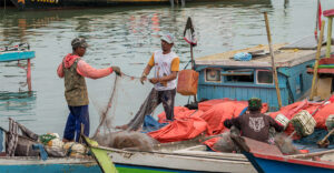
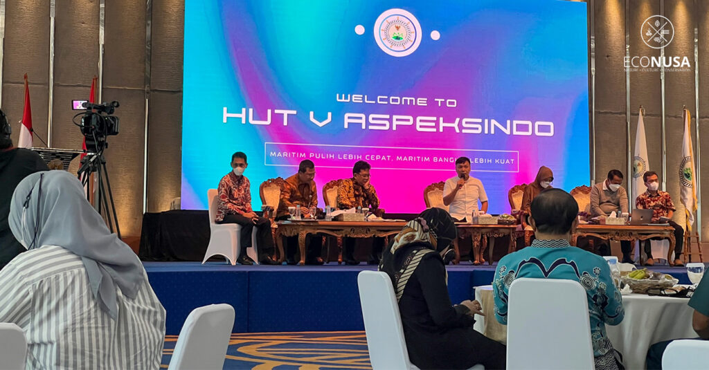
Various economic activities from ocean space grows rapidly along with the mounting risks to sea and coastal ecosystem. The statement was made by Victor Gustaf Manoppo, Director General for Sea Space Management of the Ministry of Maritime Affairs and Fisheries (MoMAF) on the National Seminar and FGD on “Protection of the Rights of Indigenous People, Traditional Community, Local Community at Coastal and Islets Areas” on 10 August 2022. The event was part of the National Coordination Meeting of the Coastal and Islands Regional Government Association (ASPEKSINDO).
As to Victor, the most essential challenge to Indonesia is how to revive economic sector through the management of economic resources creatively, effectively, adaptively to change while making it sustainable.
“MoMAF regards blue economy as the main reference for sustainable Indonesian ocean and people’s welfare,” said Victor. He added that the development strategy could be done through three major pillars of blue economy, namely ecology, economy, and social.
In blue economy implementation, MoMAF targets 28.4 million hectares of Conservation Area in 2021 as from the targeted 32.5 million hectares of sea conservation in 2030.
Customary area mapping urgent
Declaration of Wakatobi as the result of the Agrarian Reform Task Force Summit 2022 on 10 June 2022 endorsed the ministry/institution’s commitment to collaborate for agrarian reform acceleration. Some points of the Wakatobi Declaration are the efforts for making province and regency/mayoralty that are free from regulation overlapping by 2025, regional government’s commitment to speed up the Regional Bylaw on indigenous people recognition and protection, including customary area mapping and local empowerment, accelerate property registration at coastal areas, and play role in climate change protection through mangrove areas management at coastal areas and small islands.
In this context, customary area mapping is one the essential agendas to follow up by, among others, making One Map Policy (OMP). “The One Map Policy aims to set up a synchronized reference standard of geoportal database nationally,” said Kartika Listriana, acting Deputy assistant for Spatial and Land Planning of the Coordinating Ministry for Economic Affairs.
The OMP target is to accomplish 158 thematic maps in 34 provinces and 24 ministries/institutions. To date, 34 provinces have committed to complete spatial disharmony that should be done by 2024. “OMP will reduce and eliminate overlapping of spatial utilization that currently happens,” said Kartika.
Meanwhile, the Head of Customary Area Registration Agency (BRWA), Kasmita Widodo, said that BRWA jointly with CSOs have compiled 20 million hectares of customary area maps with 1,119 maps nationwide. “As from the figure, three million hectares with 189 maps of customary areas have been designated by the regional head,” said Kasmita.
As to him, most customary area maps are on terrestrial. But, some are on coastal areas and it could be collaborated with the MoMAF in relation with the spatial and social information of the indigenous people.
“Regional head needs to articulate that some maps that had been designated by a Decree or Regional Bylaw has data guardian at each region,” Kasmita underlined.
Not only terrestrial areas, sea, coastal areas need prompt mapping to get certified as done by the Agrarian Reform Task Force. “The certification here will provide legal certainty and certain habitation to the community,” said Haliana, Wakatobi Regent and ASPEKSINDO Secretary General.
ASPEKSINDO National Coordination Meeting is the strategic meeting among regional governments of coastal and islands areas nationwide to promote the implementation of Declaration of Wakatobi heading the upcoming 2023 Agrarian Reform Task Force Summit which will be held in Riau Island Province. ASPEKSINDO currently has 333 regencies/mayoralties of islands and coastal areas as its members.
Editor: Leo Wahyudi