Indonesia, apart from having the third largest tropical rain forest cover in the world, has the largest mangrove ecosystem in the world. The Ministry of Environment and Forestry noted that the area of mangrove forests in Indonesia reached 3.49 million hectares in 2015, equivalent to 23% of the world’s mangrove ecosystems. Unfortunately, of the total mangrove area, 52% or more than half of the mangrove ecosystems in Indonesia were damaged.
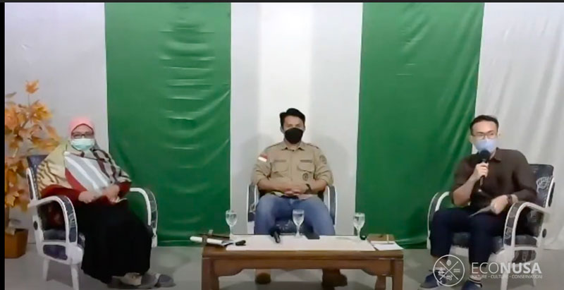
In fact, mangroves have an essential function, especially for life on the coast. Based on the explanation from the Dean of the Faculty of Fisheries, University of Muhammadiyah Makassar (UNISMUH), Erwin Wuniarto, when filling the Sail To Campus (STC) EcoNusa, the main function of mangroves is as a barrier to wind and large ocean waves. “Mangroves can withstand wind or ocean waves that enter the land so that when they hit land, they are not as big as when they hit the shore and help reduce the potential for worse damage on land,” said Erwin in a virtual webinar entitled Wanamina: Vaname Shrimp Cultivation with Mangrove Conservation which was held directly from Luwuk, Banggai Regency, Central Sulawesi on Saturday 22/05/2021.
Mangroves play a major role in the environment
In addition to minimizing the dangers and threats of land around the coast, mangroves also act as a barrier to abrasion and erosion because of their dense roots, purifying and filtering salt water. In addition, mangroves are also a habitat for marine animals and other animals such as fish, crabs, shrimp, shellfish, birds and bats, protecting and providing nutrition for animals living around mangrove forests. Even worse, mangroves are able to store large carbon stocks. “The ability of mangrove forests to absorb carbon is much greater than forests on land. Every 1 hectare, mangrove forests are able to absorb carbon 5 times greater than forests on land,” Erwin added.
The increasing damage to the mangrove ecosystem is caused by various factors. Public awareness about the function of mangroves is still low so they do not have sufficient insight to preserve them. Mangrove damage is also triggered by the development of coastal areas that override aspects of ecosystem conservation.
In addition, along with the shift from capture fisheries to aquaculture in accordance with the direction of the KKP, it actually increases the conversion of mangrove forests into aquaculture lands with ponds, especially shrimp ponds. These ponds were also built without understanding the concept of conservation so that it damaged the mangrove ecosystem a lot. Nurain Lapolo, Director of the Natural Resources Management Advocacy Network (JAPESDA), explained that Indonesia has lost around 800,000 hectares of mangrove ecosystems in the last 30 years.
“If we don’t maintain and preserve mangroves, then in the future we will not have mangrove forests that have enormous benefits for human life,” said Nurain. In fact, mangrove conservation can be done in various ways without sacrificing the economic side of the community. Erwin explained that the wanamina or silvofishery pond system could be a solution for mangrove conservation while still producing fishery commodities.
Wanamina conserves mangrove ecosystem
“Wanamina is a cultural system in ponds with traditional technology that combines fishery business with mangrove planting,” explained Erwin. Technically, wanamina consists of an integrated series of fish or shrimp cultivation activities with planting, maintenance, management, and ecological and economic conservation of mangrove forests.
In the wanamina system, mangroves have a major role in the sustainability of marine commodities developed in ponds. Physically, mangroves function to trap sediment and help hold levees. Chemically, mangroves act as an absorber of pollutants, a supplier of organic matter, and as a source of nutrients. Meanwhile, biologically, mangroves are a spawning area, nursery area, and food search area for various biota that are cultivated in ponds.
In general, wanamina has several models of ponds. The first is a model of a ditch with mangroves in the middle of the pond, and fish, shrimp, and crab farming around it which resembles a ditch. The second is the komplangan or alternating model. As the name suggests, these ponds criss-cross or are adjacent to areas planted with mangroves. The third is the path model which is a refinement of the embankment trench model with a large and wide size, about 3-5 meters with a depth of up to 80 cm. However, many ponds developed by the community are wanamina embankments. Mangroves are planted around the ponds as embankments.
As part of the effort to conserve mangroves, EcoNusa together with four universities in Banggai Regency and Poso Regency, namely UNISMUH Luwuk, UNTIKA, UNSIMAR, and UNKRIT socialized the wanamina system to the community. In addition, mangrove planting was also carried out in the ponds of residents of Uwedikan village, East Luwuk, Banggai Regency, Central Sulawesi.
Editor: Leo Wahyudi


