The Irires Tribe is one of the indigenous communities that inhabit Tanah Papua, where traditional ties among its members are functionally maintained to this day. This bond is not merely a relic of the past; it is the living foundation of their daily lives, evident in practices ranging from the communal use of forests and rivers and the mechanism of problem-solving through customary consultation (musyawarah adat) to the ritual obligations that bind clans together. This strong social system allows the Irires community to continuously maintain their communal ties and cultural identity amidst the currents of change.
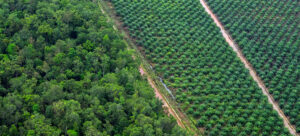
Despite these ongoing practices, their customary territory has not been fully formally registered within the governmental system. Boundary mapping has become a crucial step they are undertaking so that their rights to land and forest can be legally recognized.
Mapping Initiative and Assistance
Since 2023, EcoNusa Foundation has been providing assistance to the Irires indigenous community. Their main goal is for the community to receive formal recognition of their rights from the government. This process has progressed through several stages, including the implementation of Free, Prior, and Informed Consent (FPIC), the preparation of a work plan, the formation of community-level management institutions, and the initial collection of customary boundary coordinate data. As the work progressed, there was an indication that the customary territory of the Irires Tribe was not limited to a single sub-district, but was identified as extending into the administrative areas of Teluk Bintuni Regencyand Maybrat Regency.
Read Also: Protecting Forests, Protecting Life in South Sorong
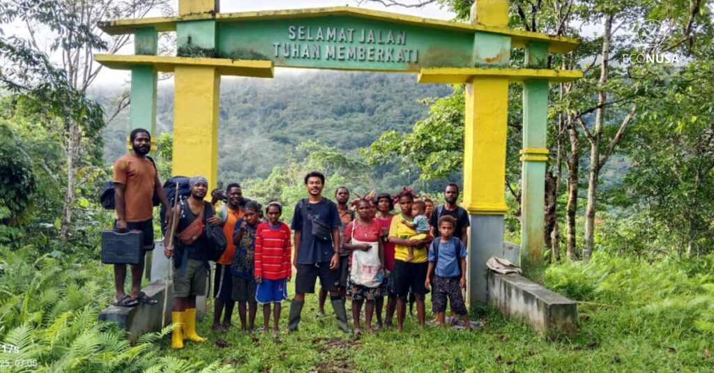
Based on these findings, the EcoNusa team scheduled a survey activity to trace and map the customary boundaries of the Irires tribe located in Teluk Bintuni Regency. After discussions and receiving full support from local village government figures and youth, the team set off on September 6, 2025.
That afternoon, the team, which consisted of two EcoNusa staff, two representatives from the Irires community in Tambrauw, and a local facilitator from Inofina village, began the journey from Bintuni town towards the remote North Moskona District (Moskona Utara Jauh). Measured on Google Maps, the distance is only about 160 kilometers. It might not sound far, but the reality on the ground was an entirely different story. For ten hours, the four-wheel-drive vehicle we were in was our only faithful companion, struggling against the severe jolting from badly damaged dirt roads and adrenaline-testing muddy tracks. Every kilometer we traveled was a stark reminder of the minimal facilities available to the community, and at the same time, it fueled our spirit to reach them.
Field Trip to Inofina
This particular journey was extremely challenging. We arrived in North Moskona District at 9:30 PM WIT. Because the road became increasingly narrow and damaged, the team decided to continue on foot toward Inofina Village. For 3 hours, we walked, navigating a slippery and dark dirt path. We arrived in Inofina Village at 12:30 AM WIT. Our tired bodies urged us to rest, but hunger kept us awake to prepare dinner. While waiting for the meal, the team planned the activities for the following day.
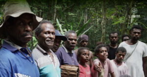
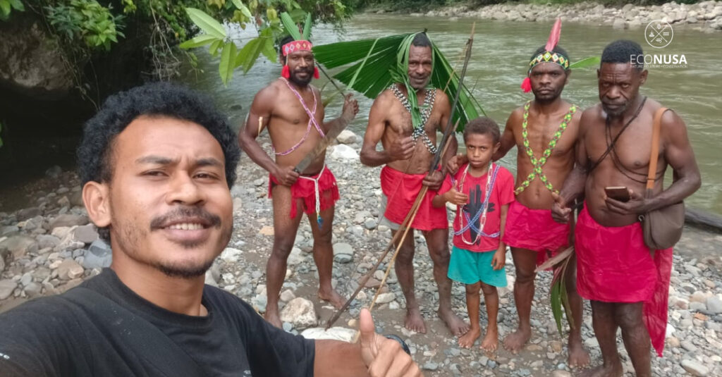
Morning arrived, and the community had gathered at the church for Sunday service. Some of the team joined the service with the community. After the service, we met with the community and explained in detail to the Moskona and Irires indigenous communities residing in Inofina the purpose of the EcoNusa team’s visit to the village: to confirm the southern boundary of the Irires customary territory and to verify the boundary clans.
Read Also: Despite Isolation, the People of Ombanariki Remain Committed to Protecting Their Customary Territory
The community joyfully welcomed our good intention, as indigenous communities in Papua are vulnerable to issues of land rights dispossession. One father in Inofina Village even said, “If the children don’t come to fence our garden, one day the wild boar will come and destroy the garden that we’ve been protecting.” It was a simple, yet clear, metaphor: without rights recognition, initiated by the mapping process, rights can be lost.
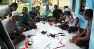
Coordinate Point Collection and Community Support
The next morning, after a breakfast of warm tea, two community representatives and local youth joined us, bringing the team total to seven people. We set off to take the southern boundary points of the Irires tribe, carrying supplies packed in bags and noken (traditional Papuan woven bags) for the long trek. As we walked through the village, people emerged one by one from their homes. Some gave us supplies of roasted sweet potato, called ipere in the local language, along with prayers and encouragement for us to successfully map their territory. This proved that the community’s concern for protecting their customary territory and forest remains strong.
The team, along along with community representatives, walked out of the village at 8:00 AM WIT, ascending hills. At 11:00 AM, when stomachs started to rumble, we paused for a meal. Afterward, the team continued the journey, climbing to the peak of Meikin at an altitude of 1,300 meters above sea level (Mdpl). Unexpectedly, heavy rain poured down, and we ran toward the nearest cave to protect the electronic equipment we were carrying. The rain subsided, and thick fog descended. We decided to set up camp to rest.
The NGO Cave (Goa LSM)
The camp was set up, firewood was collected, we had changed our clothes, and a fire was lit. While warming ourselves, we began to cook rice and share stories. Mr. E. Sasior, one of the village representatives who joined the team, said, “You are not Irires people, but you have the intention to help us. Father sees your sincerity,” he said.
E. Sasior also mentioned that the cave we were sheltering in had apparently never been visited before. Joking, Mr. E. Sasior named the cave Goa LSM (NGO Cave), to remember and commemorate the team that visited to take the customary boundary coordinates.
Aisasior River
The sun hadn’t risen, but we were already awake due to the extremely cold temperature as the bonfire had died out. It was 4:30 AM WIT. Without prompting, we divided the roles. Some looked for firewood, while others cooked rice for breakfast and travel provisions. After everything was ready and we had eaten, we headed for the Aisasior River, which marks the boundary between the Irires and Moskona tribes. Throughout the journey, we were entertained by the chirping of birds, which seemed to encourage us to continue the journey with enthusiasm.
Read Also: Preserve Papua’s Forests, Indigenous Communities Trained to Use SMART Patrol App
After a long journey of climbing and descending hills, the team finally arrived at the Aisasior River. Seeing the flowing water, we quickly put down our supplies and gear. Without hesitation, we immediately went down to the river to wash ourselves and relieve our fatigue. The fresh water seemed to wash away our tiredness.
The Arrival of the Hamlet Guardian
We decided to spend the night near the river. We set up camp there. Not long after, a hamlet guardian (penjaga dusun), Ananias Aisasior, came to us. Mr. Ananias is a member of the Irires indigenous community who lives in the middle of the forest bordering the Moskona tribe.
The presence of Mr. Ananias, the hamlet guardian, felt like finding the last piece of the puzzle. He is not just a border guard, but also the keeper of the Irires Tribe’s memory. That night, by the riverbank, we didn’t just discuss. Accompanied by laughter, we felt like we were opening an ancient map made of stories—tales of the ancestors’ journeys and the meaning of the forest as home.
From Mr. Ananias’ story, the river and the caves in the Aisasior area are witnesses to the birth of the Aisasior children who now inhabit the Maybrat, Moskona, and Tambrauw regions. It was there that we truly understood that protecting the forest means protecting their life history.
Equipped with this new understanding, our work the next day felt more meaningful. Every coordinate point we recorded was no longer just ordinary data, but a trace of the previous night’s stories. After all the data, both spatial and social, was collected, we cooked our last meal by the riverbank, then began the journey back to Inofina Village with a sense of completion.